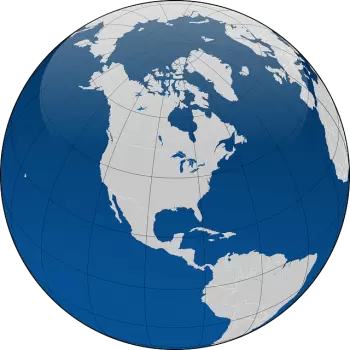
The imaginary lines on Earth are lines drawn on the planisphere map. These lines are displayed vertically and horizontally, creating a defined grid used to locate any planet point. These lines are called meridians and parallels.
We can identify any point on Earth if we know its geographic coordinates: latitude and longitude.
In particular, assuming that the Earth is in the shape of a sphere, the imaginary lines form a circle.
The essential imaginary lines are prime meridian - divides eastern and western hemispheres - and equator -divides northern and southern hemispheres-.
Meridian meaning: lines of longitude
Meridians are imaginary circles that cross the earth's surface through the North and South Pole.
Each circumference that passes through the two poles is divided into two parts, called the meridian and the antimeridian. In this way, the term meridian generally means only a semicircle with the North Pole as the starting point and the South Pole as the endpoint. In contrast, the opposite semicircle takes the name of antimeridian.
The time in each Earth region depends on the meridians: at all points on the Earth's surface that are on the same meridian, it is noon at the same time.
Each meridian and the corresponding antimeridian have a length of approximately 20004.5 km.
Only one meridian passes through each point on the earth's surface, which defines the longitude of the place. Its longitude is the angular distance between the prime meridian and the meridian that passes through that point.
What is prime meridian?
The prime meridian is a geographical reference that divides the western and eastern hemispheres.
It is a fundamental meridian, also known as Greenwich meridian because it passes through Greenwich in London, England.
The antimeridian of the Greenwich meridian crosses the Pacific Ocean and identifies the dateline.
The value of prime meridian
The value of prime meridian is 0º (0 degrees).
Continuing east to west from the Greenwich meridian, a longitude value of 0 ° to 180 ° is assigned, followed by the indication “E” if we are in the east, “W” if we are going from east to west of Greenwich.
Parallel meaning: lines of latitude
Parallels are lines that form imaginary circles perpendicular to the Earth's axis. They are obtained from the intersection between the Earth's surface and the planes perpendicular to its axis of rotation.
We can define the latitude through the parallels that are the angular distance between the equator and the parallel passing through a given point. The equator is assigned a latitude of 0 °. The latitude varies from 0° to 90°, followed by the indication North (N) or South (S) moving from north to south.
What are the five major parallels?
The five most significant parallels of latitudes from north to south are:
-
Arctic Circle
-
Tropic of Cancer
-
Equator
-
Tropic of Capricorn
-
Antarctic Circle.
Solar radiation is perpendicular to the Earth's surface in one of the tropics during the solstices.
What is the Equator parallel?
The equator is the fundamental parallel that divides the Earth, forming a plane perpendicular to the Earth's axis. This plane divides the Earth into two hemispheres: the northern hemisphere and the southern hemisphere.
All other parallels are imaginary circles parallel to the equator.
The equator is approximately 40,075 km long. Each parallel is gradually shorter in length, starting from the Equator and moving towards the Arctic Circle and the Antarctic Circle.
The equator is the parallel on which the sun's rays fall perpendicular to the earth's surface at the equinoxes. It is the border between the northern and southern hemispheres.
Difference between parallels and meridians
The Meridians are the imaginary lines that cross parallel to the axis on which the earth rotates. They divide the planet vertically, from the North Pole to the South Pole. An example of a Meridian is the Greenwich Meridian, which gives the possibility, among other things, of classifying West and East.
Meanwhile, the Parallels are the imaginary lines of the earth that cross perpendicular to the axis on which the earth rotates.